I promised at the end of my subway post that I’d cover this next, and I think it might actually be more important than the subway post itself. You can learn how a turnstile works in thirty seconds. Figuring out why your phone isn’t giving you directions while you’re standing on a street corner with luggage is a much worse problem to solve on the fly.
Why Google Maps Still Isn’t Enough Here
Here’s the short version of a genuinely strange, decades-long story: South Korea has restricted the export of high-precision map data outside the country since 2007, on national-security grounds tied to the fact that the Korean War ended in an armistice, not a peace treaty. Google requested an exception in 2007, again in 2016, and both times was turned down. That’s the reason Google Maps in Korea has historically been fine for looking at a map, but weak at actual turn-by-turn directions, transit routing, or up-to-date business listings.
This is actually in the middle of changing right now, which is worth knowing. In February 2026, Korea’s government conditionally approved Google’s request to export the data, under strict security conditions — a real reversal after nearly two decades. But as of this writing in August 2026, implementation has stalled: Google and the government are still working out the technical and compliance details, and Google still isn’t offering full turn-by-turn navigation in Korea. So the practical situation for a visitor today is basically unchanged — Google Maps is fine for browsing and saving places before your trip, but you still need a Korean map app once you’re actually trying to get somewhere. Keep an eye on this if you’re traveling later in the year; it could genuinely be resolved by the time you land.
That’s where Naver Map and Kakao Map come in — the two apps virtually every Korean actually uses to get around.
Naver Map vs Kakao Map: The Two Apps You Actually Need
A quick correction before the table below, because it’s worth being upfront about: both apps are genuinely full-featured, general-purpose map apps — each one does transit, walking, driving, and place search and reviews. It’s not a clean split where one app “does transit” and the other “does driving.” Where they actually differ is more subtle:
Stair-avoidance routing, and (added June 2026) real-time turn-by-turn walking navigation — a first among Korean map apps
Friends Location sharing, tightly integrated with KakaoTalk
Worth knowing
Popular starting point for most first-time visitors
A close second — occasionally finds a route or place Naver misses
(One more app worth a mention if you’ll be renting a car for a long road trip: T map, made by SK Telecom, is actually the single most-used driving navigation app among Koreans. It’s less tourist-friendly since English support is weaker, so I’m not covering it in depth here — but it’s worth knowing it exists if a local passenger ever tells you to just use Tmap instead.)
The Kakao Map app icon — a yellow square with a blue pin.The Naver Map app icon — a blue-to-green gradient pin with a white N.
Honestly, I’d just install both. They’re free, neither needs a Korean phone number for the basic features, and each one is occasionally better than the other for a specific situation — which I’ll get into below.
Step 1: Set Both Apps to English
Naver Map usually follows your phone’s system language automatically — if your phone is in English, Naver Map opens in English. If it doesn’t: tap the menu icon (☰) in the top corner → Settings → Language → English.
Kakao Map needs a manual switch the first time: from the home screen, drag up the bottom sheet to find the settings icon → App Settings → Language → English.
One thing to expect either way: even in English mode, some business names, reviews, and smaller labels will still show up in Korean. That’s normal — it’s not a translation bug, it’s just how locally-sourced map data works. The parts that actually matter for getting around (route steps, station names, transit info) come through in English just fine.
Step 2: Search for Where You’re Going
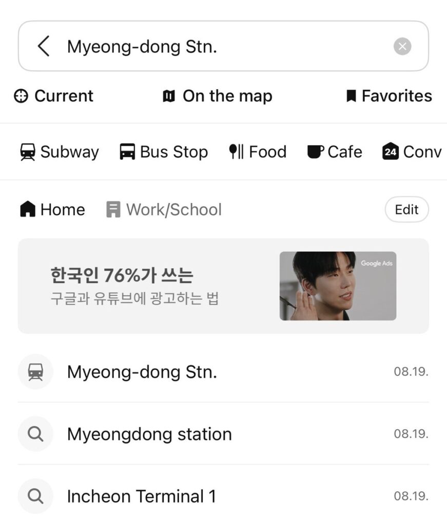
Both apps work the same basic way — tap the search bar, type an English name or address, and pick from the results. Recent searches and shortcuts (Home, Work/School) save automatically once you’ve used the app a few times.
Searching for Myeong-dong Station on Kakao Map — recent searches and quick category filters (Subway, Bus Stop, Food, Cafe) sit right at the top.
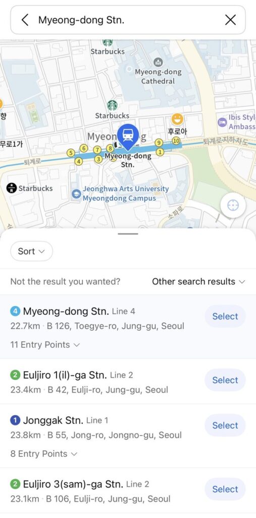
Once you pick a result, both apps drop a pin and show you the immediate surroundings — nearby landmarks, cafes, and, usefully, subway exit numbers directly on the map.
Kakao Map showing Myeong-dong Station with numbered exits marked right on the map — the same exit-number system I covered in the subway post.
If you read my subway post, this is exactly the numbered-exit system I mentioned there — seeing the numbers on the map before you even arrive makes it much easier to pick the right exit once you’re underground.
Step 3: Get Actual Directions
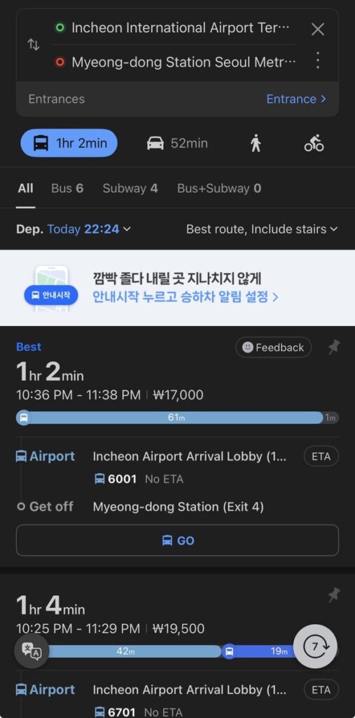
This is where the two apps earn their keep, and where Google Maps still falls behind. I tested both apps on the same real route — Incheon International Airport Terminal 1 to Myeong-dong Station — and the results are a good illustration of how each app thinks.
Kakao Map’s subway option:
Kakao Map’s subway route from Incheon Airport to Myeong-dong: 1 hour 32 minutes, ₩4,750 — Airport Railroad to Seoul Station, then transfer to Line 4.
Naver Map’s options for the same trip:
Naver Map’s fastest option for the same trip: a direct airport limousine bus, 1 hour 2 minutes for ₩17,000 — notably faster but considerably pricier than the subway. Naver also flags a stair-avoidance routing option, useful if you’re traveling with heavy luggage.
That’s a genuinely useful trade-off to see side by side: the subway is roughly a third of the price but half again as slow, while the direct airport bus costs more but drops you close to your exit with no transfers and no stairs. Neither app is “right” — they’re just optimizing for different things, which is exactly why it’s worth glancing at both before you commit to a route, especially right off a long flight.
Step 4: Driving and Real-Time Traffic (Naver’s Strong Suit)
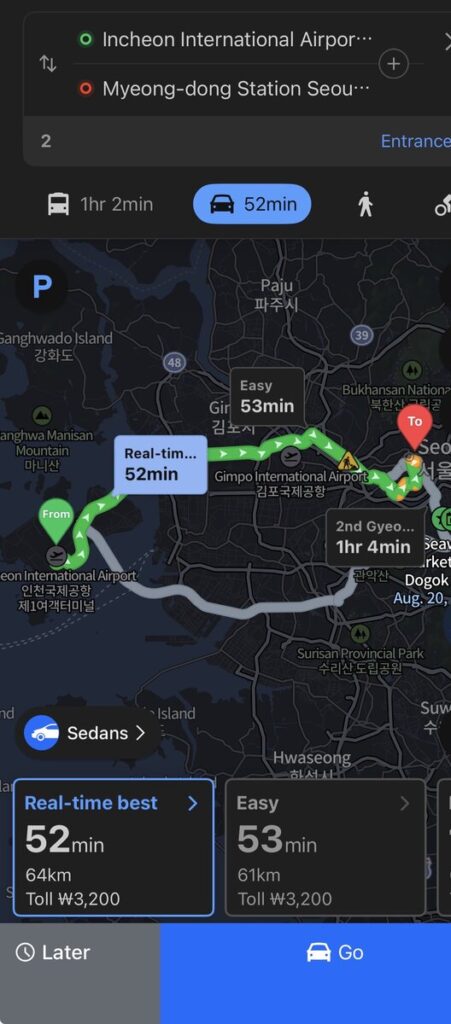
If you’re taking a taxi or a rental car rather than transit, Naver Map’s driving mode is worth a look — it shows real-time traffic-adjusted routes side by side with toll costs.
Naver Map’s driving directions comparing a ‘Real-time best’ route (52 minutes, ₩3,200 toll) against an ‘Easy’ alternative (53 minutes) and a lowest-toll option — genuinely useful for taxi rides.
Suggested caption: “Naver Map’s driving directions comparing a ‘Real-time best’ route (52 minutes, ₩3,200 toll) against an ‘Easy’ alternative (53 minutes) and a lowest-toll option — genuinely useful for taxi rides.” Suggested alt text: “Naver Map driving route comparison from Incheon Airport showing real-time traffic times and toll costs”
(Quick related note: Kakao Map itself doesn’t hail taxis — that’s a separate app called Kakao T, which is Korea’s dominant ride-hailing service. Worth downloading alongside these two if you’ll need cabs.)
Step 5: Just Browsing? Both Apps Are Also Good for That
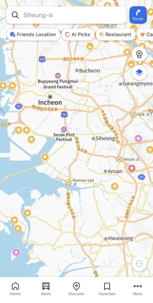
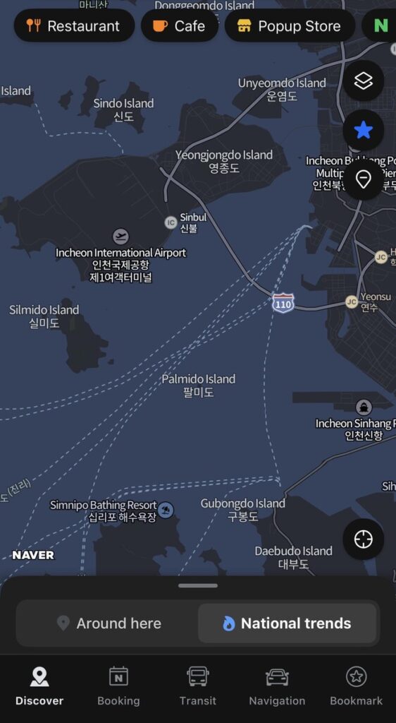
Beyond point-to-point directions, both apps double as a general “what’s around here” discovery tool, with restaurant, cafe, and trending-place recommendations baked in.
Kakao Map’s discovery view, with quick filters for Friends Location, AI Picks, Restaurant, and Cafe.Naver Map’s Discover tab, including a ‘National trends’ feed of currently popular places.
So Which One Should You Actually Use?
Honestly, this isn’t a clean “one app wins” situation — plenty of long-term foreign residents here swear by Kakao Map, and plenty swear by Naver, and the two apps are closer in capability than most comparison posts make them sound. If I had to hand a first-time visitor exactly one app to start with, I’d lean toward Naver Map, mostly because of its foreign-language polish and detailed walking directions. But I’d install Kakao Map right alongside it — it costs nothing but a bit of phone storage, and every so often one app finds a route, a transit time, or a place the other one misses.
My actual workflow, and what I’d suggest: use Google Maps before you land to browse neighborhoods, read English reviews, and save pins to a list — it’s genuinely fine for that. Once you’re on the ground and actually trying to get from A to B, switch to Naver or Kakao. That hybrid approach gets you the best of both, and it’s still the right call as of today — though as I mentioned above, keep an eye on the news if Google’s map export finally goes live before your trip. I’ll update this post if that changes.
One final warning: No offline maps. Unlike Google Maps, neither Naver nor Kakao allows you to download map areas for offline use. You will absolutely need an active data connection (an eSIM, local SIM, or portable Wi-Fi) to use them on the street.
This is part of an ongoing series of practical guides for visitors to Korea. If you found this useful, check out the first post on using the Seoul subway, or let me know in the comments what you’d like covered next.
I’m a Seoul native, and lately I don’t have to look far to see it: the growing wave of global interest in K-culture has brought more international visitors to my city than ever before. Seoul is where I spend most of my daily life, and these days it’s common to hear several different languages on…